


(Image source from: })
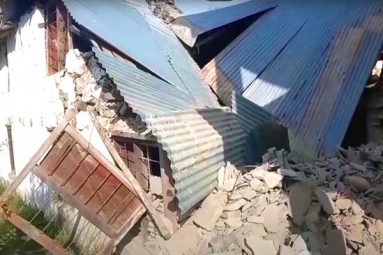
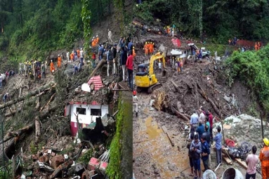
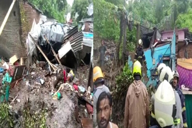
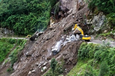
Uttarkashi is in the edge of an enormous landslide as the Varun Parvat or Varunavat mountain developed a 4-5 -inch wide crack that is 25-meter-long. Landslide, if occurs, mostly affects Indira Colony and Jansu residents of India's Uttarkashi region. Those houses built under the foot of the Varun Parvat are particularly under very high risk.
Essential steps taken at Uttarkashi
District Magistrate Indudhar Bodai told that they are totally aware of the situation and said that orders for blocking the road lying in front of the Tamba Khani tunnel have been issued. Few cracks have also been developed at the stairs constructed aiming the treatment of the mountain.
A report indicating the situation has already been sent to the administration. Eventually, two teams of geo-scientists scientists have been deployed by the administration to survey the damage at the spot. They will even recommend appropriate solutions required to tackle with possible landslide.
Where is Uttarkashi located?
Situated at an altitude of 1352 m above sea level, Uttarkashi is located on the banks of river Bhagirathi. Uttarkashi means Kashi of the north. This town is in Uttarakhand, India and is the district headquarters of Uttarkashi district. Situated on the Ganges, Uttarkashi lies besides Varun Parvat or Varunavat mountain. Manikarnika Ghat is located in Uttarkashi, which homes number of ashrams and temples and also to the Nehru Institute of Mountaineering.
-Sumana